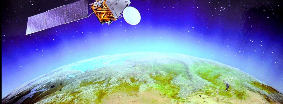
Turkmenistan plans to build and launch another satellite into orbit
In his speech to the Elders’ Council in October, President Gurbanguly Berdymuhamedov identified wider use of cutting-edge space technology in various sectors of the national economy as key short-term tasks. By a decision of the head of state, some 1 billion 300 million manats are to be allocated for the domestic space industry development in 2018-2024.
The funds will be spent on building and launching a remote sensing satellite. Along with that, the money will go to pay for the considerable expansion of the industry’s ground-based infrastructure, personnel training, and research activities in the field.
The establishment of the National Space Agency (NSA) under the President of Turkmenistan in May 2011 and the launch of the satellite TürkmenÄlem 52°Е into near-earth orbit in 2015 (which has greatly benefited the communications industry) ushered in the era of space technology in Turkmenistan.
“Not only does this represent a real technological breakthrough for our country, it is also the event of great ideological and political importance. Turkmenistan sent its first satellite into space with good intentions, pursuing great objectives. Our state closely adheres to the principle that outer space should become an area of peace, understanding and mutual cooperation for the benefit of all humanity”, – President Gurbanguly Berdymuhamedov said.
The National Space Agency is responsible for improving satellite communications services, conducting space research, and operating and maintaining control of the satellite from ground-based facilities in Turkmenistan. The NSA has reported that TürkmenÄlem 52°Е currently remains in a desired geostationary orbit, and ensures reliable television broadcasting on the national channels. The Agency’s staff members monitor the motion of the orbiting satellite and operate ground-based facilities.
High-capacity transponders enable TürkmenÄlem 52°Е to broadcast scores of SDTV and HDTV channels. Its payload includes modern equipment designed to provide a package of triple-play communications services. At present, broadcasting-satellite service (BSS) is retransmitting programs broadcast on television and radio channels of Turkmenistan. Satellite lease agreements have been concluded with companies from many countries. Local ministries and agencies make full use of the services available via the national satellite. Turkmen Hemrasy Closed Corporation renders satellite communications services to foreign companies operating in our country’s oil and gas sector.
Orbiting the Earth at the height of tens of thousands of kilometers, TürkmenÄlem 52°Е ensures access to communications services in remotely situated settlements in the Kara Kum Desert, in particular for residents of the village of Kirpili, Baharly etrap, Akhal velayat and the village of Oilygushlyk, Balkan velayat.
Remote residential areas were connected to the satellite transponder by specialists of Turkmentelecom, the state telecommunications company, and Turkmen Hemrasy Closed Corporation (which deals with commercialization of the satellite capacity (payload) and renders services both in Turkmenistan and abroad).
The new satellite is expected to accelerate the development of all sectors of the national economy, and is highly promising in terms of its future applications. The remote sensing space vehicle will also collect data about hard-to-reach, fast-moving and other objects, enabling to observe vast areas.
Remote sensing of the Earth’s surface is being used as an alternative to expensive, comparatively slow and time-consuming data collection methods. For instance, in the power industry, it makes possible to create electronic maps of power lines and transformer stations, to gather, process and store the data, and to assess the technical condition of facilities.
Remote sensing techniques are also used to ensure environmental and legally justified monitoring of oil fields, pipeline corridors and oil refineries, including to determine the scale of oil spillage and to control the activity of companies involved in extracting fossil fuels and minerals. They have practical applications in geosciences (for example, in natural resources management), agriculture (sustainable use and conservation natural resources).
The techniques will allow capturing images of separate areas with predictable regularity, calculating the area of farm fields, obtaining data about the condition of farmland. In particular, the satellite will enable farmers to control the amount of completed agri-works, to determine the areas with poor growth of crops, to assess the need for fertilizer application, and to predict crop yield. The data can be used to optimize farm work and to exercise distant supervision over field operations.
Satellite images will increase manifold the effectiveness of systematic monitoring of ongoing construction projects, road construction and maintenance activities, ecological conditions of urban and rural areas, the Caspian shelf zone, etc.